South Coast Track Tasmania
South Coast Track Tasmania Wilderness Area January 23rd 2016 8 days
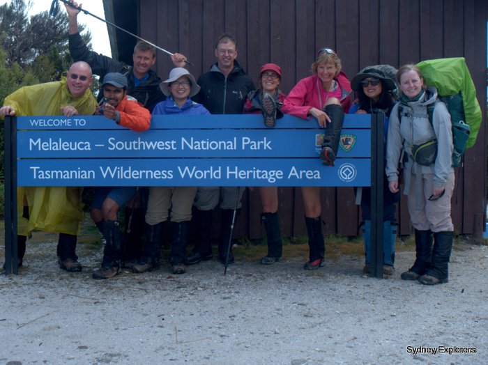
We were all quite excited as we were picked up at our accommodation in Hobart for the transfer to Cambridge aero drome and our short flight to Melaleuca anything we had forgotten to pack in our 18kg backpacks was too late to remember now!
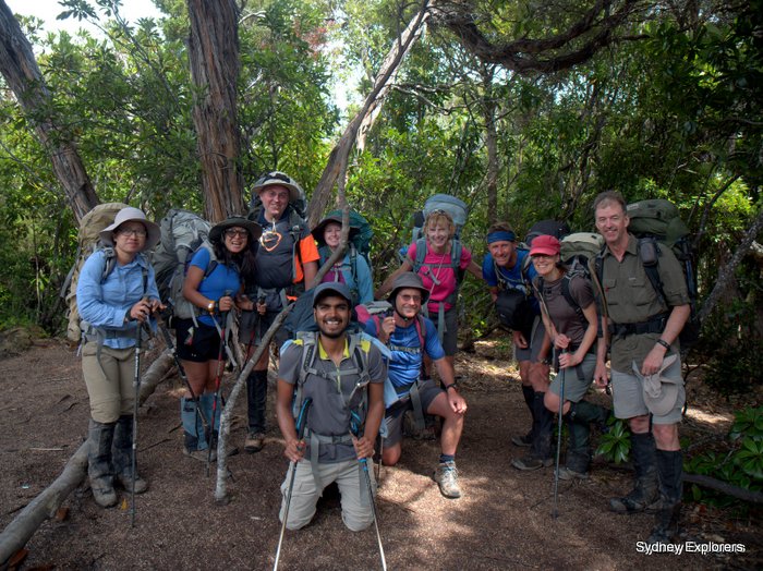
Check in was a little slow after all it was Saturday morning and ten of us, plus there was another group of six and a couple more walkers to boot, also a couple of flight seers going just for the flight and a look around although not much to see at Melaleuca! Backpacks weighed and all good average was 18kg or so although for some reason check-in did not weigh us like they did the other groups and passengers we were soon outside in the sunshine looking at our small plane 7 and 9 seater’s twin engine aircraft operated by Par Avion.
Soon we were boarding a small plane, seat belts on and headphones on for the noise, some testing of the engines etc as it was the first flight of the day and whoosh down the runway we shoot and up into the skies above south Hobart turning sharply to the west and settling down into an easy flightpath to our destination about 45 min away, we were split into two planes as there was 10 of us 7 in one and 3 in another, Thomas flying the lead aircraft reported turbulence in front the plane bobbing up and down a bit with poor Norman using the barf back, of which he missed but his camera bag came to the rescue! We turned early missing the bulk of turbulence and soon approaching Melaleuca however over the headphones came, the weather has closed in and may not be able to land if that’s the case we will return to Cambridge that was a bit of a blow!
Thankfully after a full circuit Thomas said there is a window in the weather let’s give it a try to land and in we went, quick, steep and on the ground in no time that easy. Light wind blew in mist and jackets were donned, backpacks adjusted and walked to the huts for water and finalise our plans for the first days walk to Point Eric, just a few metres from the huts is a bird hide great for viewing orange bellied parrots but alas none appeared to brave the weather for us.
South Coast Track Tasmania Day 1 Melaleuca to Point Eric 13km
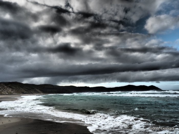
Off on our first days walk along the South Coast Track was a mix of board walk and easy trail, some sections were over grown and as we push through the bush heads disappeared in the undergrowth terrain was fairly flat and track remarkably easy to follow our last section headed up to the slopes of New Harbour Range along a mix of steps eroded and deep ravines ridden track almost at the top of the trail an easy spot for lunch even though mist was still blowing in the wind but we were getting hungry. A short climb to the top of the trail and views of Cox Bight lightened our mood, down we headed to the beach and soon clambering down eroded steps onto the wild soft sand of Cox Bight windswept and beautiful views, no footprints!
Our pace picked up as we walked across the beach knowing our first campsite at Point Eric was on the other side we clambered up the sand dunes and off the beach and headed into the bush expecting camp to be metres away but the track was hard to find through the dense bush at one point losing the trail and following another pathway clambering over fallen trees and bashing through bush until we stumbled into a campsite yeah! Point Eric campsite is on the other side of a small peninsular facing the beach, sheltered with a creek running into the beech offering lovely fresh clear Tasmanian water.
After setting up tents and camp Yen and Maj-Britt decided to hit the surf for a swim, shrieks and screams followed by incessant laughing as the cold bites! Mel decided up to her knees was enough before retreating from the shrieks and laughs and cold sea, after all we are facing Antarctica! As the sun started to head behind the horizon although behind the thick clouds a few bounced onto the beach for sunset yoga or at least something they thought resembled yoga looking more like the dancers in YMCA… Up early Sunday morning breakfast was quick and packed up in no time, unfortunately Srini was not on the same wavelength and after 8 days took out the wooden spoon for most times late and last packed/departing!
South Coast Track Tasmania Day 2 Point Eric to Louisa Creek to Louisa River 16.5km
We set off at 08:30 although Srini was late and finally set off 08:40 did we learn to set the time earlier for Srini, no we did not! Today’s walk included our first major river crossing to wade, aided by a rope strung across the river, first we headed up over undulating hills and up a steep section just over 210m ascent deeply eroded in places overgrown losing sight of each other bush bashing heads popping up out of the bush occasionally like a meerkat keeping watch, at the top a spotted qual came trotting down the track, then turned and ran back then forward, then jumped off the track bounced through the undergrowth to the back of our group looked up at the walkers then trotted off down the track again! Finally dropping down to Faraway Creek our river crossing, as the weather has been dry the last six months of so in Tasmania we have been lucky in the condition of track and rivers as not so much water/mud around. We decided to boots off and wade across in Crocs/sandals etc water was lovely and refreshing on our feet, the rope was handy as stones were slippery on the bed of the river, across the other side clambered up steps and had lunch rain started to fall and we tried to shelter under the trees, we sat on branches and huddled under bushes to keep dry whilst dipping into our salmon sachets and crackers the water in the river was pitch black from the tannin then an easy trail to our 2nd nights camp Louisa Creek across the other side of the river of course! Although wide it was shallow again a rope strewn across for safety as the rocks we very slippery indeed.
Unfortunately the group ahead of us of six had already arrived and pitched camp at first we struggled to find a place to pitch tents, Katey found a spot for herself but I returned to check on everyone crossing the river, Srini and Maj-Britt still taking their time on the other side and LAST.
I explored several tracks and found a large camping area by the river, a father (from Netherlands) and daughter now living in Hobart) had pitched tents with still plenty of room for the rest of us. AS the rain started to fall we tried to fix up a tarp for a shelter with limited success, contract track workers had permanent tents in one corner with large tarp shelters so some used these in their absence the rest of us made do and had an early night.
South Coast Track Tasmania Day 3 Louisa River to Little Deadman’s Bay 12km over the Iron bound range
We set Srini and Maj-Britt a 5am wake up and 7am departure time hopefully so they would be ready by 8am! Thankfully it worked and we were all ready to depart on time and head up the boardwalk out of the bush to open button grass plains, we could see the Ironbound range in front of us but was shrouded in cloud so could not actually see how high we had to climb, maybe this was fortuitous! Soon we were climbing up a winding track in good condition steep in places but we climbed then steps some eroded but up we climbed, views behind us started opening up across the bay, then the coast looking down on our tiny winding track and boardwalk into the trees and our campsite. Cloud came and went, mist blew in on the wind and dissipated but regardless of whether you wore a jacket or poncho wet was the order of the day sweat or rain made no difference. Granite boulders and outcrops signal the edge of the top of the range, however a last section climbing up over eroded board walk onto the range itself gave way to wind and cloud blowing through cold, cloudy wind limiting our view and willingness to stay on top and enjoy being for a moment on the highest point of the south coast track about 900m above the sea below, our group had split up by this stage as the inexperienced walkers not donning a jacket to keep warm and waiting for the rest of the group but instead walking on.
We knew down the other side was rough, heard many stories of tree roots, mud and fallen branches etc but we expected to be in camp by 4pm, alas as we headed down past the high camp ground (which makes a great lunch spot close to a creek) with relative ease after a new board walk just installed made walking easy, we finally caught up with the rest of the group sitting on an open clearing overlooking the coast wind blew through chilling everyone so even though 1:30pm and no lunch we decided to keep walking down hoping along the trail somewhere we could find a spot to stop for lunch. The track quickly disintegrated into running creeks, mud, tree root obstacle course, fallen branches, trees and mud that deep, sticky glorious mud, of course the South Coast Track is famous for mud but along with all the other obstacles made it a long tough descent. After a couple of hours descending all sorts of obstacles, trudging through mud knee deep in places, climbing over wet fallen trees and wading through running creeks we arrived at our first open spot which was the low camp ground small with signs of a campfire, Ian fired up his GPS and said the campground is 116m further on, off we trudged dejected and hungry! Crossed a creek which fired up alarm bells in me, yes on the map the campground is before the creek, after queering with Ian he replied must have entered the campground on his GPS incorrectly, as we started to cross the creek via a narrow channel the rocks were slippery so I advised everyone where to cross, one big step should do it, Maj-Britt refused stating I’m going where I am going and immediately slipped into the creek knee deep in running, cold mountain water, Srini gave her a hand up, we were all across dry and safe except one!
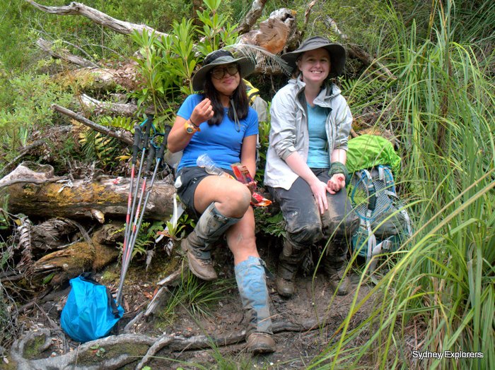
The trail climbed a little but we were know on forest tracks, much easier walking, after a 100m or so a fallen tree had been sawn in half for access along the track and the branches made excellent seats for our lunch break now around 3:30pm. The trail through the forest was fairly easy apart from sporadic pockets of mud, deep, sticky, slippery mud, our boots by this stage were sodden with water, I was sure I could hear a frog croaking from inside mine, caked in mud our long gaiters keeping it out of our boots but could not do the same for the water. A few fallen trees were negotiated but even though tired we made OK time along the much easier trail through the forest and finally into Little Deadman’s Bay a nice campsite with beautiful clear freshwater running into the bay, the campsite is slightly elevated over the bay giving nice views, our tents quickly pitched and gear hung up on lines to dry taking advantage of a gently sea breeze. Tired and hungry we cooked up a feast, frustrated by the total fire ban, other walkers were in camp too and friendly happy to chat and mingle even though we were 10 walkers. A very good night’s sleep indeed and a late start the next day!
South Coast Track Day 4 Tasmania Little Deadman’s Bay to Prion Boat Crossing 9.5km
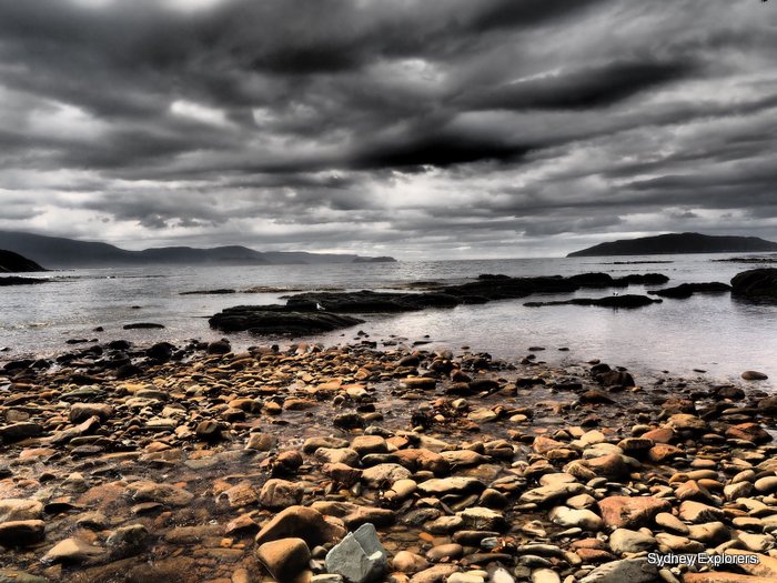
We awoke to plenty of rustling and busyness around the camp the small group was setting off early and the 3 hikers doing the walk in reverse was up with the sunrise and off to tackle the Ironbound range crossing. We were to depart late today after a gruelling Ironbound crossing, everyone was tired and looking forward to an easy day, a lazy breakfast packed up and enjoyed our last few minutes at Little Deadmans Bay we dropped down onto the stoney beach and up the other side via a small scramble up a eroded path and crossed a creek again aided by a rope strewn across for support in heavier waters, again due to lack of rain recently water was shallow. Forrest trail was a delight a few scattered sections of steep trail with sporadic muddy sections, trees down etc one tree was ingeniously carved into walking steps jumping off the end. Green was prevalent now lush ferns, trees and bushes, grass trees and various grasses luscious and greens of all shades, sunlight filtered through creating a myriad of shades and bright spots. We crossed a couple of spurs before over a headland and coming to a steep drop down to the beach where we stopped for morning tea although a little late besides Grotto Creek a timely top up of water! Originally we planned to add the section from Prion boat crossing to Surprise bay but given the time will opt to stay at Prion Beach.
Our next section was across Prion Beach from Grotto Creek, this was a flat beach windswept and wild but sun was shining and it looked glorious, a quick walk across the beach enjoying the sun, cool fresh breeze straight from Antarctica and hard sand to walk on, we arrived at the end of the sand dunes signalling a turn to the lagoon, we searched for the boat crossing and found it just behind the sand dunes, one row boat on each side, thankfully! One boat had rowlocks the other a botched rope rowlocks which was the row boat on our side, it would be wouldn’t it? We pulled the tin rowboat down to the water’s edge I jumped in the row boat and threaded the oars through the botched rope rowlocks oh joy I thought this is going to be fun… I took Mitch, Yen & Melinda across the lagoon, seemed to have things pretty well under control even though the rowlocks were bloody annoying, arrived the other side, we dragged the other tin row boat down the beach to the water’s edge Mitch picked up the other oars and this one had proper rowlocks, sprinted across the lagoon like a trooper, I on the other hand decided it would be a great idea to tighten the rope rowlocks and boy did I stuff that up! Rowlocks would not allow the oar to angle down into the water as they were too tight, I managed to loosen the right side but not the left hence could row around in circles… Managed to loosen the left a little more but still kept going off to the left eventually reaching the other side again some way up from where I was supposed to be then rowing back down to the beach.
Eventually Mitch had everyone across the other side, we stored the row boat and oars and went to check out the campsite!
We were ready for a relaxing day, sun was shining would be great weather for a swim, Mt Precipitous stood proud behind the campsite offering lovely views BUT march flies were everywhere, big buzzy march flies swarms of them annoying even the calmest of walkers, the two dutchies (father and daughter) arrived early but barked “We are not staying here the water is shit and those flies are horrible, it’s a crappy campsite” we did agree but could not be bothered in packing up and moving on. Alas they were right about the water, gee deep dark brown, algae and bits and pieces everywhere, we picked up 3L of this murky stuff treated it and settled down into camp, Ian came back and said the water was better if you follow a short path around 100m up the creek it starts to run and is clearer, some great news for sure, but those flies! The afternoon was relaxing, we did some washing, explored the foreshore and found a few base campers (campers bringing all their gear into one spot and pitching a large campsite for the week) they were all from Sydney in fact suburbs just up the road go figure. A paddy melon decided to pay us a visit in the campground but soon hopped off into the bush with nothing much found to eat apart from being caught sniffing Kathy’s dried vegetable bag and a few other tasty bits.
Sunset was lovely as we had our dinner on the water’s edge, down by the beach flies seemed less here and of course the views were nicer, cool fresh breeze blew across the lagoon as we sipped our hot tea and munched on our noodles, the night sky was clear and bright as the sun dipped below the horizon a myriad of stars and a gloriously bright southern cross beamed across the night sky.
South Coast Track Day 5 Tasmania Prion Boat Crossing to Surprise Bay and Granite Beach 12km
We had mixed feelings about leaving today one we knew the flies would be a pest if we stayed for our rest day but two we were unsure what the Granite Beach campsite would be like and that was our last chance of a good positioned rest day. After breakfast and a quick pack up, yes Maj-Britt and Srini were last again we took a group photo on the beach we walked back through the campsite and up over the sand dunes, a bit different to what most would imagine as sand dunes as shrouded in bush, trees, bushes and grasses, undulating of course, down into dune traps then up the other side eventually after about 1.5 hours arrived at the end of the dunes and a drop to the river mouth, a rope was hanging from a tree to give us assistance but with a full pack a bit of hassle so off with bags and scramble down once all down safely off the ledge a run down the sand dune to the river was fun for most!
We waded Milford Creek a shallow stream and stopped for water on the other side, this creek ran onto the beach but the water was fresh and tasted good after Prion Beach. As we walked east under a large sand dune the creek cut into the base of the dune making us wade through fairly deep water, sometimes just over knee high, then a few tree branches down giving us an obstacle or two to negotiate soon at the base of the track climbing up onto the top of the dune, a rope and chain ladder made it fun but challenging with a large pack on our backs but after a break on the beach lapping up the sunshine we clambered to the top and made our way towards open plains anf forested hills crossing a small creek along the way through beech forest and rocky tracks before dropping down to the west end of Surprise Bay.
Crossing the beach past some rocky headlands thankfully low tide but could be a problem if it was high, to the east end of the beach and Surprise Rivulet, this was a gorgeous beach and the river flowed fast into the sea, just about calf deep, a rock formation gave a little shelter from the strong breeze as the white billowing clouds blew across the sky. Lovely soft sand but we had to make Granite Beach! We clambered up some eroded wooden steps and into Surprise Bay camp, stopped for lunch amongst moans and groans of why we could not stop on the beach! Never mind it’s sheltered and comfortable here plus we have shade and a further 3km to walk to Granite Beach. After lunch we wandered around the campsite, gorgeous views over the bay, I wondered what Granite Beach camp would be like and wished we could stay here but adding the 3km to our next part of the track was not a great idea and thankfully we moved on to Granite Beach.
We had a bit of climb although only about 200m ascent this took us by surprise as expected it to be easy, scrubby forest and over a spur above Shoemaker Point before dropping down to Granite Beach, a steep descent but wow what a glorious beach, large pebbles formed in the middle of the beach creating an obstacle course to clamber over, balance needed to be spot on even with our heavy packs and remember to stay off the wet ones! Maj-Britt found a wet one right at the end and slipped up laughing as she hit the sand.
As we arrived below the cliffs at the end of Granite Beach the sun lit up the mini water fall glistening as it tinkled over the cliff, just enough for a shower we thought fantastic! Up the cliff we clambered and at the top gorgeous pools of fresh Tasmania water trickled down and fell over the cliff edge like and endless stream of lemmings. Camp was just a few metres ahead and a lovely choice of spots, top of the site was a couple of spots with open views back along the beach and cliffs yonder, or sheltered deep amongst the trees or out in the middle of the site slightly sheltered but open to the sky something for everyone. We were happy to arrive and pitched tent, once formalities done Yen, Norman & Srini raced off to the beach for a swim, body surfing and playing in the waves before a shower under the clean Tasmanian fresh water fall. As we settled into our dinner routine the wind had increased some of that roaring 40’s had started to blow through camp a little unnerving for those that had untested tents but all good in the end, we erected a tarp for shelter from a sprinkling of rain and sat to chat in the comfort of our hiking chairs and hot tea.
Today was a rest day, 6 silly buggers thought it would be a great idea to hike 2km up the hill we head up tomorrow on our way to South Cape Rivulet, there is supposedly a lookout point offering amazing views back along the track to Iron bound range but in the end they did not actually get there, they did find some mud and we should have raised alarm bells then but thought nothing of it. Thankfully I am not that way inclined and had a lazy morning in camp, a late breakfast and walk onto the beach while Mel and Yen decided to put on their dumb and dumber impersonation by sitting in camp and catching flies by clapping their hands, after two hours I returned to them sitting gleefully clapping their hands clap 45 clap 46 clap 47 big smiles and laughter by both of them! Left quite an impression on me to say the least, surely must have been something in the water…
Winds subsided it was a day of swimming, relaxing on the beach, photography and general relaxation on our rest day, perfect sunny skies and cool breeze made this a day to remember on our South Coast Track adventure, Kathy, Mitch, Maj-Britt and the others returned from their lookout excursion covered in mud, we did not give in another thought after being caught up in the moment of a beautiful sunny day on the wild south Tasmanian coast.
South Coast Track Day 7 Tasmania Granite Beach to South Coast Rivulet 9km
We were expecting this to the an easy day, into camp early for a swim in the river or sea, relaxing watching the sun go down and looking forward to our last days walk into Cockle Creek our transfer to Hobart and real food and cold beer! Alas easy it was not, we knew it was a steep climb nearly half as much as the Iron Bound Range up to 400m ascent in one go but a total of 715m in ascents as we head up down the other side then up again and so on, unfortunately it was not that straight forward either, we started our climb to find a muddy trail, it was sprinkling with rain so the bush was soaking wet, we clambered over a couple of fallen trees then into bush and out the other side, up we walked muddy, wet and slippery, trail began to be eroded and deep rivulets formed, clambering up and through ever deeper mud we came to the lookout point, the six who came up the day before on their rest day did not make it this far they claimed!
Gorgeous views over the southeast coast, dark clouds forming and threatening with heavy rain, I hoped it would hold off for a couple of hours as we would be into camp by then surely, Dave’s famous last words, as we came to the top of South Cape Range the track deteriorated into a quagmire, deep wet sticky mud, a scream and a loud laugh billowing out from behind, Kathy slipped and fell knee deep into mud, Norman helped her up and set off again, another loud laugh this time Yen slipped knee deep in mud and so it went on… We came to several large very deep muddy sections, some had bypasses some had logs strewn to assist in spreading the weight and avoid sinking knee deep in mud, one such side trip sort of led to know where and it took us another 30 minutes to find our way back onto the track again, so easy to get lost up here seems quite common to take a side track aimed at circumventing the muddy section only to find it has many side tracks off it as people get lost and make knew tracks into oblivion, thankfully we did not come across anyone wandering aimlessly in the bush which I half expected.
Today’s walk was much harder than expected we were one trying to stay dry and mud free and two get through the mud as best we could, best in the end would have been to walk straight through the mud and clean up after, gee what a photo that would have made! In the end the 12km walk took 9 hours to complete finally through the mud we entered forested paths still with patches of mud but the knee deep stuff had been left behind, a few trees to scramble over or under and the odd patch of eroded track to negotiate but finally came to the descent to South Cost Rivulet a long slow descent through beech forest and tree cover, a glimpse of beach through the trees and I shouted with joy “Beach” then singing “I can see the beach and sea we are nearly there”! After a hard days walk we wandered up and down the river looking for the shallowest part of the river to cross, all looked at least calf deep if not knee deep, not being bothered to take off boots I waded across, almost knee deep but we were know on the other side and looking for any signs of the campsite.
There were now obvious signs of a campsite, the map showed it on the bend in the river so walked up towards that end of the beach and sure enough there was our campsite, a few campsites with a lovely river & cool fresh water flowing down into the sea, I checked the water gorgeous no treatment required. Pitching tent at close to 5pm it was time for the kettle to go on and a hot cup of tea, a wander up the beach and relax in our camp chair for a natter about the day and our last days hike tomorrow, I had planned this hike to avoid South Cape Rivulet on weekends as it gets busy with locals coming up for a weekend, even then Friday night there were two permanent tents seems as though the occupants had been here a while and not really wanting to mix in so guess they were wanting to get away from it all for a while, what a wonderful spot to do it too.
South Coast Track Tasmania Day 8 South Cost Rivulet to Cockle Creek 11km
Our last day walking, we knew 11km was going to be fairly easy but required to be into Cockle Creek by 10:30am I had a taxi booked to take 7 of us out to Geeveston then catch the 2:45pm bus to Hobart so needed to start early and arrive on time, Mel, Maj-Britt struggled to keep up with a medium fast pace so decided to let them walk in at their own pace and take the second taxi about 12 midday, we found the track easy and well maintained, track was over cliffs and along board walk and well maintained trail through forest, at Lion Rock we crossed a beach and headed up wooden steps alas the wrong ones and came into a campsite instead, back down the steps and along the beach to the end some beautifully hewn sandstone steps and been put into the cliff up to the top of coal bluff and along its edges, a sign Tasmania’s most southern point had been erected but we could see two points both left and right with must be more southern! Anyway inward the track turns away from the coast, along boardwalk and through forest the track starting to head down towards Cockle Creek, long stretches of boardwalk and the sounds of phones ringing with messages coming in, the first time we had reception for the last 8 days!
I phoned the taxi booked Dover Taxi as I was a little worried about whether he would be there or not, did not come across with too much confidence in the two prior calls I made but fantastic yes he was on his way, oh by the way he said I headed down yesterday as you said Friday pick up, I actually called on a Friday to confirm get my gist?
We walked into Cockle Creek and although not much to see took a few photos and boarded the taxi, a Toyota Commuter with a wheel chair lift at the back limiting seating capacity to 7 so as six of us were there we jumped in and off we went to Geeveston, a cute little logging town now with a few tourist attractions but a fantastic pie shop, we had an hour to waste and wandered through the farmers market, oh boy the best plums I have had in years, firm and juicy, sweet and lovely flesh gorgeous, bacon and egg roll was OK nothing special should have had a pie they looked great!
Our last hooray on our South Coast Track was a group dinner at Fluke and Bruce pub in Hobart, table was booked for 10, Katey, Mitch, Yen and myself were early for a cold beer, pork scratching for starters and potato skins too, lovely way to start a night of celebration, most of us opted for steak, I chose a 400g rib eye on the bone gorgeous, cooked to perfect, lovely big chunky beer batter fries and salad too, cold Tasmanian beer and great company, what a way to finish our trek!
South Coast Track Tasmania Important Info: Best time to trek is February when weather is supposed to be stable, however you can actually hike this track all year round, no fees apply except national park fees, check the webpage https://www.southcoasttrack.com.au/ and check Tasmania National Parks for up to date information, the track is for experienced hikers only, you must be prepared for all weather and there are many muddy sections along this trail, the track itself is not well maintained and in places not maintained at all. I used John & Monica Chapman South Coast Track guide was was invaluable thank you to both for creating such and easy to follow but informative guide book
South Coast Track Tasmania: Always be prepared, follow Tasmania National Parks walk safely procedures here: http://www.parks.tas.gov.au/indeX.aspX?base=5576
Getting there and away: Most walkers fly into Melaleuca with Par Avion http://paravion.com.au/ then walk through over 6-8 days (longer if you wish) to Cockle Creek a small settlement which has several shuttle bus operations and a taxi service. Cheaper option for taxi is a ride to Geeveston then local bus to Hobart with Tassie Link bus lines http://www.tassielink.com.au/tassielink-timetables
See the full photo album here:


